4 Reasons Building a Hiking Trail is Like Gardening

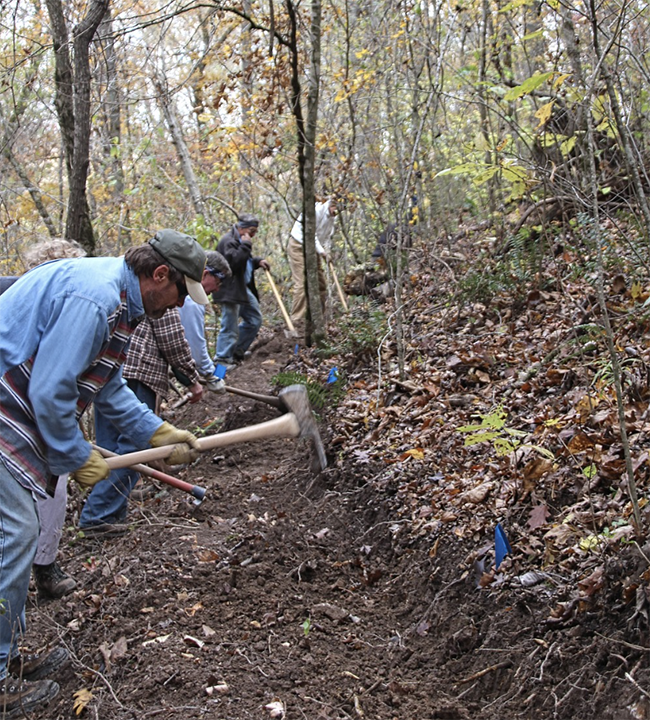
Building a hiking trail and gardening may not seem like they have much in common, but in reality, they share many similarities. As someone who enjoys both activities, I’ve noticed that the process and mindset required for each are quite similar. Here are four reasons why building a hiking trail is like gardening.

When selecting plants for a garden, it’s important to consider factors such as intercropping, soil type, sunlight exposure, and climate. Similarly, when selecting vegetation for a hiking trail, it’s important to choose plants that are native to the area and can thrive in the local climate and soil conditions.

Continue Reading →

Local Trails

The Southern Terminus of the Appalachian Trail is on Springer Mountain on the eastern edge of Gilmer County. The Trail continues north for 2,179 miles through 14 states to its Northern Terminus at Mount Katahdin in Maine. A cool interactive map of the AT trail will fuel your imagination as you plan an outing. To see how far it is between two points on the AT, check out this distance calculator.

The Cohutta Wilderness Area contains 39,677 acres (about 60 square miles) of rugged mountain terrain. The area contains the headwaters of the Jacks and Conasauga Rivers, both of which contain native trout. The area has an extensive trail system with several loop hike opportunities available. Many of the trails require river crossings, so keep an eye out for heavy rains, which can make those crossings dangerous or impossible.

Continue Reading →